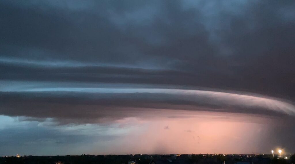
On Tuesday evening, many people in the south of the West Flanders province spotted an exceptional cloud formation, with images likely showing the development of a supercell with a shelf cloud in front.
Tuesday's thunderstorm showed an exceptional "shelf cloud", which is only seen a few times a year in Belgium, above the municipalities of Bissegem, Roeselare and Wielsbeke.
A shelf cloud is part of a much larger cumulonimbus formation (thunderstorm cloud) and occurs when colder air from a thunderstorm moves over much warmer air at the earth's surface, creating a layered effect. It often hangs down diagonally or vertically from the cloud base, resembling a shelf.
Due to the long period of drought this summer, the cloud had not yet been seen this year.
"The suspicion is growing that a 'supercell' was formed in West Flanders on Tuesday evening, which later caused very heavy rain and severe wind gusts in the area of Zeeland in the Netherlands," meteorological service NoodweerBenelux stated on its Facebook page.
A supercell – which NoordweerBenelux calls the "king of the showers" – is the kind of cloud that storm chasers travel hundreds to thousands of kilometres every year to witness. They usually produce abundant rainfall, hail, strong wind gusts and downbursts. Wind spouts (the same as a tornado) are also a possibility, but it only occurs in a minority of cases.
The video shows the initial stage of the exploding thunderstorm over West Flanders, said NoodweerBenelux. "At the front, we can see a beautiful shelf cloud. This supercell was accompanied by special cloud structures and locally also hail."

