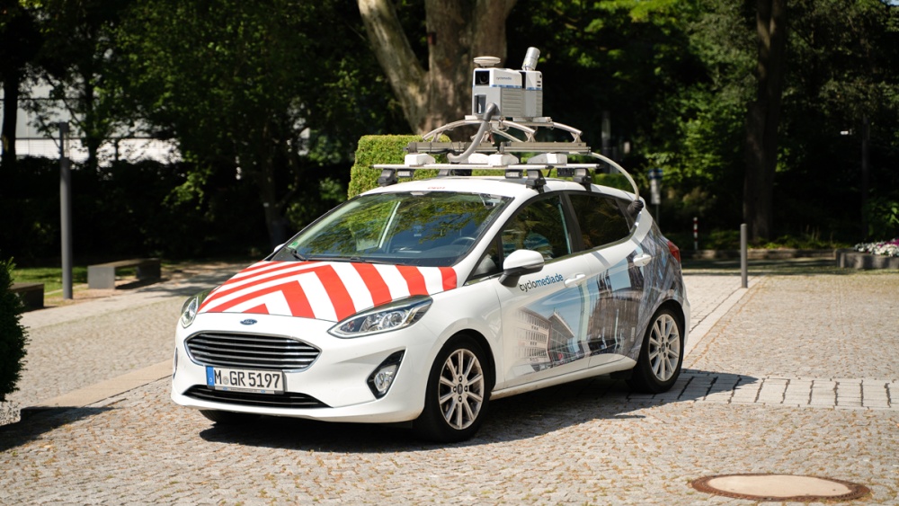
Cars fixed with a large metal box of equipment to their roofs have travelled more than 100,000 km to map the entire Belgian territory.
After completing a 360-degree panoramic imagery map of all of Flanders in 2021, which has been used by more than 50% of towns and municipalities as it facilitates roadworks and maintenance, the Dutch company Cyclomedia has completed the "most accurate and up-to-date" mapping of Belgium's entire territory.
Cyclomedia's cars, which can be easily recognised by the four cameras fitted to them, travelled several thousand kilometres across Wallonia and Brussels to capture more than 16 million panoramic images at street level to accurately map the current road infrastructure.
As well as capturing 360° images, the vehicles simultaneously performed a complete three-dimensional (3D) scan with a very high density of the streets with its Street LiDAR (Laser Imaging Detection And Ranging) technology, which the company says guarantees the highest possible quality and accuracy.
This technology, which consists of determining the distance to an object using laser pulses, provides a cloud of points representing the external environment which can then be converted into a 3D model using its software.
Using data
Belgium is now the fourth country to be fully covered by Cyclomedia, following the Netherlands, Luxembourg and the Czech Republic.
"Every month, our 70 cars cover 44,000 km to capture and visualise public spaces in Europe and North America," Bart Verbeeck, sales director of Cyclomedia in Belgium, told La Libre Belgique.
The company, which is active in 31 countries, argues that the geodata offered by its Smart Street is more precise than Google's "Street View" service, provides images from different angles, but also more up-to-date images, as the information is renewed every year so that the images remain current, while Google does not automatically collect new images every year nationwide.
Related News
- Google using AI to predict flood risks in Belgium
- Belgium in Brief: 360° visions of the European capital
The main value of the product is its business tool, through which it extracts additional information for its customers, providing an in-depth mapping to simulate modifications. It is currently working with Belgium's Proximus to calculate and forecast the costs of building a new fibre optic network across the country.
It can also help public authorities predict the impact of certain roadworks, from the development of cycle paths to the deployment of electric vehicle charging stations, by testing various scenarios with the visualisation of public spaces.

