Belgium may be small but it has a lot of nature to offer. From the hills and valleys of the Ardennes to the North Sea dunes and ancient forests in between, these are the best walking and hiking trails in the country.
Whether you are planning a family-friendly afternoon walk, a scenic stroll along the coastline, an exploration of the heathlands or a (multi-day) trek through the dense forests and hills in the Ardennes, Belgium has something for everyone.
Le Fondry des Chiens
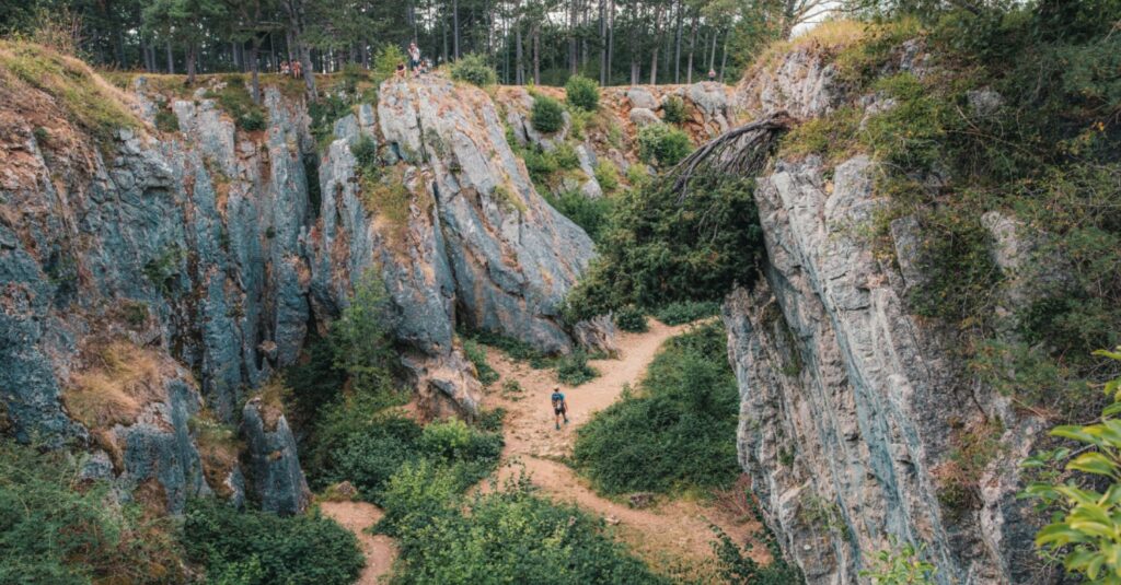
Le Fondry des Chiens. Credit: Visit Ardennes
The Ardennes are renowned for their forests, plateaus and hills. But hikers sometimes stumble upon rare gems such as 'Le Fondry des Chiens', a natural site that seems almost like another planet. Located in the Viroin-Hermeton nature park above the village of Nismes, the 20-metre-deep sinkhole, is protected and unique in Belgium and is the result of millions of years of rain erosion in the limestone.
Closeby is a beautiful limestone grassland where thousands of blue flower heads of the rare puffer flower stand out in spring.
Those who just want to see the sinkhole can drive almost right up to it, but a great 4 km hike also gives hikers a view of the whole site. The loop walk takes about 1.5 hours and starts at the church of the town of Nismes. It is easy to follow by the red rectangle signposting.
Westhoek Walk
Credit: Belga/Laurie Dieffembacq
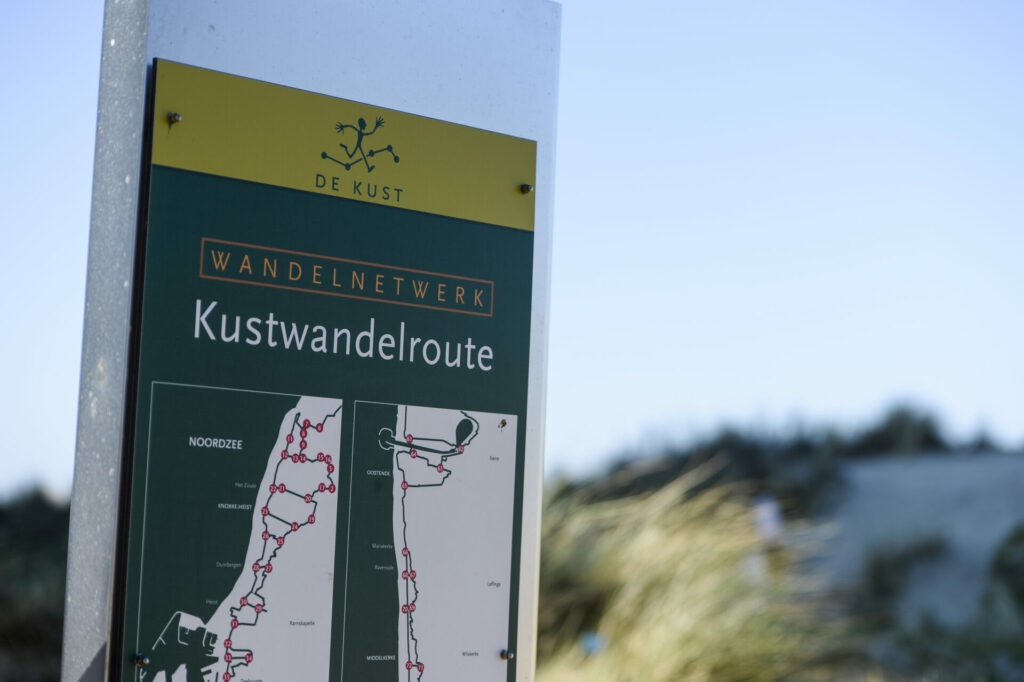
It isn't only the Ardennes that has beautiful walking trails – Belgium's coast also has a lot to offer to hikers willing to trade forests and mountains for dunes and grasslands.
The Nature Reserve de Westhoek is one of Flanders’ oldest nature reserves and protects 11 different dune habitats. For history fans: archaeological excavations in the area have unearthed objects dating back to the Iron Age.
A roughly 10-km walk begins in the Calmeynbos elm forest but quickly moves into the dunes. While the terrain undulates slightly, it is generally fairly level. But mainly on loose sand, it can make for quite a workout.
Terhills' Connecterra - National Park Hoge Kempen
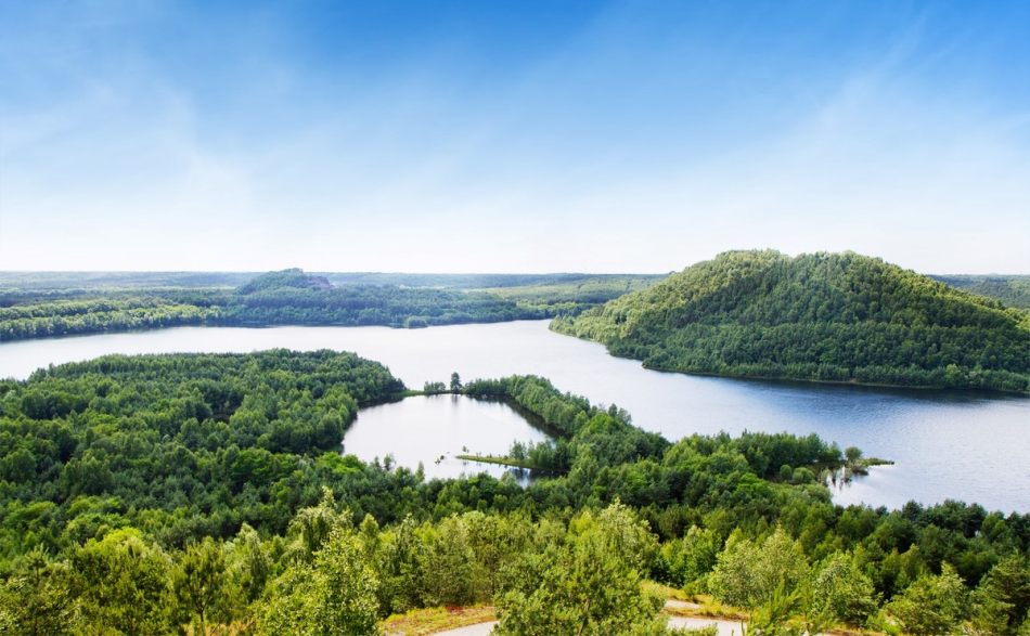
Credit: Connecterra
Branded 'the most beautiful panorama in Flanders,' the landscape of Terhills – which used to be called Connecterra – in the National Park Hoge Kempen in the Maasmechelen municipality offers a surprising variation of "mountains and lakes" and is included on the UNESCO Indicative World Heritage List.
The area was the site of the Eisden coal mine until it closed in 1987. After that, it was cleaned up and nature was allowed to take its course. Connecterra is now home to various species of butterflies and plants and features two mine shafts (one in its original state, one renovated), three slag heaps full of nature, extensive ponds, creeks as well as swampy and wooded areas.
Four marked walking routes range from simple and relatively short jaunts around the lake to real treks over (one of) the three hills. The routes vary from 1.4 km to 10.9 km, but there is no obligation to follow them – visitors can roam freely.
From October to March, the site is open from 10:00 to 17:00. Access is free. More information can be found on the website.
The Ladder Walk and the Giant's Tomb
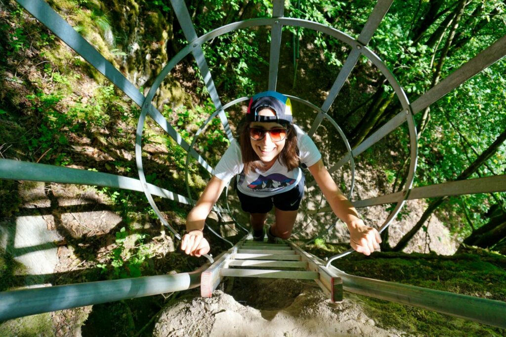
Credit: Promenade des Echelles
Despite the fact that it only stretches 5km, the so-called 'Ladders Walk' takes adventurous hikers up to impressive viewpoints across challenging terrain in the Semois Valley in the city of Arlon, in the Luxembourg province.
A great choice if you are looking for a bit of adventure, the trail involves several sheer ascents and descents made by ladder. They date back to the 1930s when the local government installed them as a way to reach a hidden rock shelter as part of its preparations for the coming war. Later, they were incorporated into the extensive trail system.
Starting in the village of Rochehaut, the trail soon leaves the cobblestone streets behind as it makes its way past farm fields and stables into dense forests, before going down to the river and up again to a beautiful lookout over the Semois Valley.
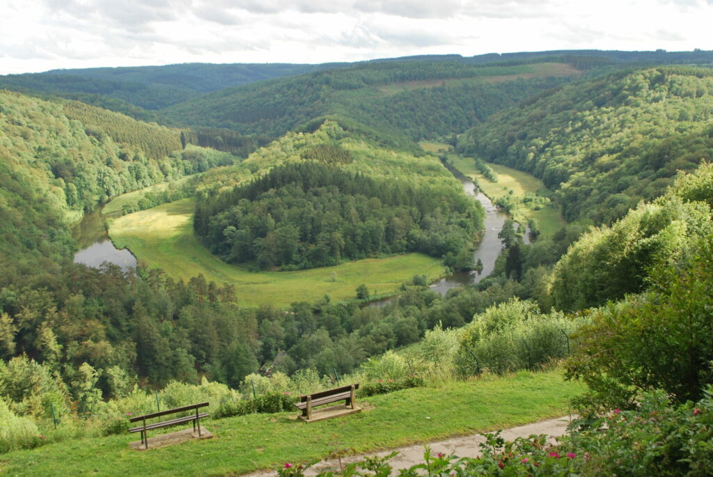
Le Tombeau du Géant. Credit: Wikipedia
Not too far from there, the Botassart walk towards 'Le Tombeau du Géant' starts – widely regarded as one of the most beautiful in the Ardennes. Following the Semois river, it leads hikers in a horseshoe shape around the Tombeau du Géant hill, which gets its name from the legend of a Gallic hero – "a giant" – who refused to be captured by the Romans and instead threw himself from the Rocher des Gattes.
A number of well-marked paths traverse the hill, varying from 3 km to 13 km and starting in the town of Bouillon – all of 'medium' difficulty. For the best views, be prepared for a steep climb.
Blotevoetenpad (barefoot path)

Credit: Blotevoetenpad Lieteberg
Though not an actual hiking trail, the Barefoot Path is plenty adventurous and ideal for an afternoon digging your toes in the mud, looking for creepy crawlies in the sand or splashing through a pond – with or without children.
While Belgium currently has at least eight barefoot paths, the first one opened in the municipality of Zutendaal, in the Limburg province. The concept is simple: take off your shoes and socks and walk for almost 3 km on a controlled surface of wood, stones, wood chips, grass, loam and water.
You wade through water features, climb sand hills and steep slopes and find your way through a labyrinth. An 18 metre wooden watchtower also gives a great view of the Hoge Kempen National Park. Afterwards, you can enjoy a drink and a slice of real "Limburgse vlaai" in the cafeteria or on the terrace.
The Barefoot Path is open every day between 10:00 and 17:00 until 7 November, when it closes for winter. Tickets cost €4.50 for children shorter than 120cm and €6 for adults. Reservations are not necessary unless you are planning a trip with a group of more than 20 people.
More information can be found on the website.
Battlefield of Waterloo (1815 Walk)
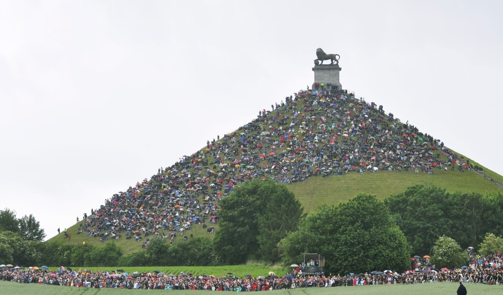
The Lion Mound in Waterloo attracts thousands of visitors every year. Credit: Belga
Those interested in both nature and human history can visit Waterloo in the Walloon Brabant province and tread in the footsteps of the Duke of Wellington and Napoleon's army on a 14-km walk around the historic site of the battle that changed the map of Europe.
The trail crosses the fields and beautiful landscapes of Eigenbrakel, Genepiën, Lasne and Waterloo, passing by a number of important sites commemorating the famous Battle of Waterloo with monuments, memorials, farms or key places where Napoleon's French army went to war against the Allies.
Hikers will encounter the 40m high world-famous Lion's Mound monument dedicated to those who died in the battle (and which likely contains human remains), the memorial to the 1200 Belgians killed, the La Hougoumont farm, Napoleon's last headquarters, the panorama of the battlefield, a number of museums and many other things.
The 14 km route has an elevation gain of just over 200m and is rated as medium; many restaurants and taverns are located on the route. The trail can also be completed by bike, or for those craving a truly historic feel: on horseback.
GR56 and GR5
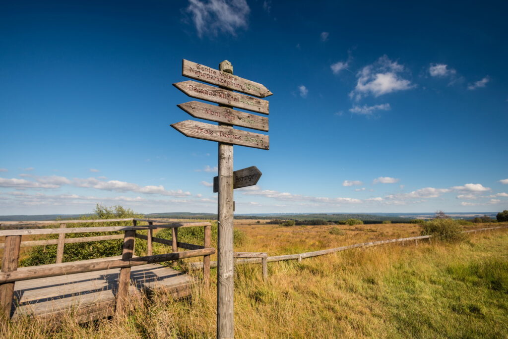
Credit: Belga
Those looking for a true multi-day trek can do (part of) the 167-km GR56 loop in the Belgian Ardennes – one of Belgium's oldest trails on the GR (short for 'Grote Routepad' in Dutch or 'Grande Randonnée' in French) network of long-distance walking trails in Europe, indicated by white and red stripes.
The area has always been popular with hikers and takes you through forests, villages, fields and meadows as well as along rivers, past beautiful churches, chapels and even a castle.
The trail starts in the town of Sankt Vith (in the Liège province) and proceeds north through the Emmelserwald woods, crossing the Amblève river and descending to the village of Malmedy via slopes and valleys. It continues into the High Fens and drops down again through the valley of the Perlenbach before the trail through fields and forests.
Those interested in turning their multi-day trek into a multi-week one can also hike the (much) longer GR5 trail, connecting the Dutch coastal village Hoek van Holland to Nice in the south of France over a distance of roughly 2,150 km. The route largely navigates through mountainous areas and requires decent fitness and good equipment. Thorough preparation is recommended.
It is also possible to just walk the Belgian part of the trail all the way from Essen (in the north of Antwerp) to Ouren, at the border triangle of Belgium-Germany-Luxembourg.

